
Community Engagement Portal
Morehouse School of Medicine Community Engaged Inventory and Geographic Information System Mapping Project
A geographic information system (GIS) is an electronic approach designed to capture, store, manipulate, analyze, manage, and present all types of geographical data. While the use of GIS mapping has begun to gain traction in identifying “hots spots” of health morbidity and mortality, far less has been done to promote and visualize the reach of community-academic partnerships designed to advance health equity.
In 2016 Morehouse School of Medicine conceptualized the Morehouse School of Medicine’s Community Engagement Inventory and GIS Mapping Project to sustain a comprehensive inventory of MSM community-engaged initiatives (CEIs) in the areas of:
- Research
- Clinical Healthcare
- Service to Communities
- Training of current MSM learners, including faculty/staff and students
- Educational outreach with learners external to MSM, including K-12 pipeline programs
CEIs are activities that directly serve, interact or collaborate with community residents or community-based organizations. Products and initiatives that will emanate from the inventory will include:
- A centralized and regularly updated searchable database on the leaders, roles, relationships and reach of CEIs towards improved collaboration, partnership development, reduced duplication and strengthened community presence
- Detailed reporting of CEIs listed by geographic area
- Geographic Information System (GIS) mapping that visually depicts the reach of MSM CEIs in the State of Georgia and beyond
Beyond solely depicting Morehouse School of Medicine partnerships, the CEIs depicted also include community-based organizations, social services or resources independently working to promote or serve neighborhoods.
The screen shot below depicts an example of a community-engaged research study, by geographical location, complete with description and contact towards demonstrating Morehouse School of Medicine community-academic partnership within a specified zip code.
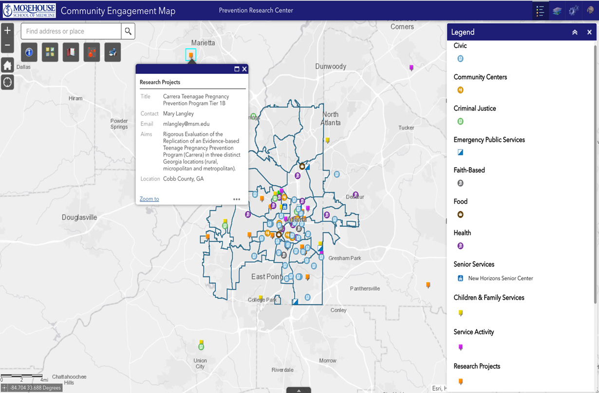
Other surrounding resources depicted by symbols on the map show surrounding community resources or social services (faith-based, civic/community centers, etc.) that the end-user may consider for partnership or referral.